by Josh Sadlier
Ah, America the beautiful. Few countries can match the natural beauty that we enjoy from sea to shining sea. Throw in our incredible network of secondary roads, which allows automotive access to virtually every inch of that beauty, and the U.S. is arguably in a class of one. The only problem is deciding which breathtaking byway to tackle next.
We know the situation: the weather’s nice, you’re itching to hit the road, and you’re just not sure which American driving roads are really worth your time. We want to help, so we mined our staff’s collective wisdom and came up with our favorite five driving roads in the United States. If you’re looking for roads that make driving an end in itself, these are the cream of the crop.
Four Mountain Passes, Southern Sierra Nevada, California
There are no fewer than four major roads that go up and over the majestic Sierra Nevada mountain range between Lake Tahoe and Yosemite National Park, and we’re cheating and going with the whole lot, because it’s impossible to pick just one. We’ve heard of people driving all four passes in one day, and that would be our recommendation to you if you’ve got the time (and gas money).
The fun starts on the southern end with the Tioga Pass, which runs through the heart of Yosemite, snaking past Half Dome and ultimately up to 9,943 feet–the highest pass in the Sierra Nevada–before descending to its eastern terminus at Mono Lake. Next up is the 9,624-foot Sonora Pass, which skirts ancient pines and numerous alpine lakes and meadows, providing perhaps the best scenery of the bunch. Farther north is Ebbetts Pass (8,736 feet), a rewarding but highly demanding drive that requires particular vigilance on account of its numerous steep switchbacks and stretches of unmarked pavement. Finally, Carson Pass (8,574 feet) affords epic views of indigo-blue Red Lake, among others, and if you’re up for a hike to Red Lake Peak (10,068 feet), you can catch a glimpse of Lake Tahoe to the north.
Just make sure you hit this stretch during the summer – snow closures affect most of these roads during the winter.
Kancamagus Highway, White Mountains, New Hampshire
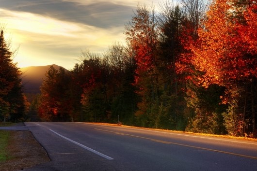
Non-natives may be surprised to see a Northeast representative on this list, but New Englanders know all about the Kancamagus Highway. Covering roughly 33 miles between Conway, NH and Lincoln, NH, the Kancamagus has it all: elevation changes, beautiful White Mountain vistas, and long, sweeping curves that involve you in the drive without frightening any passengers you might have brought along. As an added bonus, it’s a top destination for fall foliage viewing. If you start in Conway, incidentally, consider hopping a train when you get to Lincoln: the Cafe Lafayette Dinner Train takes you on a scenic 20-mile ride while you enjoy a five-course meal.

Photo Credit: Nietnagel (Flickr)
Tail of the Dragon, Smoky Mountains Region, Tennessee
Also known simply as “The Dragon,” this 11-mile stretch of asphalt is renowned for its 318 curves, many of which have been given affectionate names by the countless driving enthusiasts who come to pay homage. But a need for speed is hardly required; you could cruise through in a Winnebago and still be seduced by the excellent mountain views. If there’s a downside, it’s that there’s basically nothing nearby, but there’s always the option of a secluded weekend at the highly rated Sweet Berries Bed and Breakfast, which is just 15 miles or so up the road from The Dragon.
Route 89/89A, Grand Canyon Region, Arizona and Utah
To be clear, this isn’t the place to enjoy a quaint weekend getaway. If it’s some sort of revolutionary spa treatment you’re looking for, you’ll want to catch a flight to Sedona instead. But if you’re up for roughing it a little in a stunning and rugged landscape, then by all means, get yourself to the Arizona-Utah border, and bring a very large memory card for your camera.
The itinerary we recommend starts in Page, AZ and heads northwest to Kanab, UT along Route 89 before turning south onto 89A, which takes you to the Grand Canyon Highway and eventually to the North Rim of the Grand Canyon (an epic drive in itself). But you can really start anywhere you like on this route, because there’s not a single mile that’s not scenic. Everything from the sand to the rock formations is Martian red, and the scale of it all is impossibly vast. If you have time to linger in Page, try to work in a day trip to Antelope Canyon; it’s a great chance to get up close and personal with the unique geological features of this area.
Highway 1, Big Sur Region, California
It may seem arbitrary to single out the southerly Big Sur section of California’s famed Highway 1, because almost the entire state-spanning road is a thing of beauty. You could start to the north in San Francisco, head farther north to Mendocino, and come away convinced that you just drove the most amazing road in existence. But there really is something special about the part between Cambria and Carmel, which is what we’re referring to here. The elevation gains from the Pacific Ocean to Big Sur’s coastal peaks are unequalled outside of Alaska, and the road itself is a remarkable feat of engineering, perched precariously as it is on cliff-sides high above the waves. A roadside sign near Carmel sets the stage: “HILLS CURVES NEXT 63 MILES,” it informs southbound drivers, and if you’re like us, you’ll just want to turn around and drive it again when you’re done.

